continent
2016
[Map] W520 x H440 (mm), [Glass] W170 x D220 x H50 (mm)
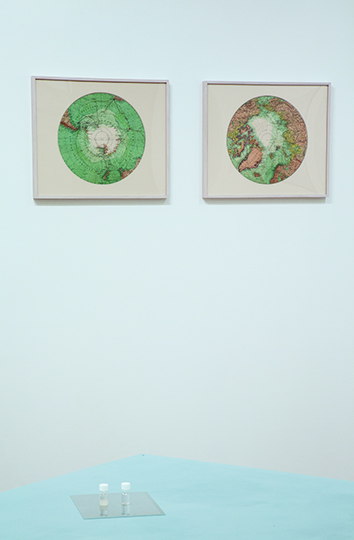
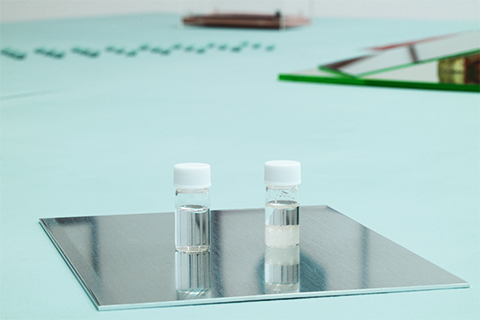
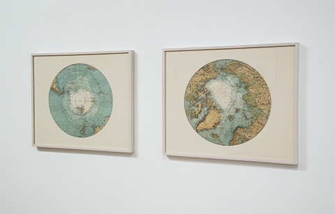
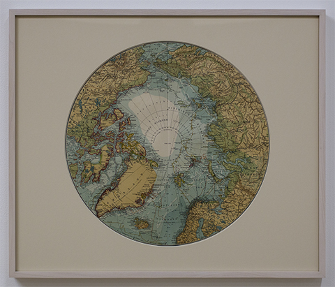
Arctic and Antarctic Map 1908, Antarcticite, Water, Glass bottles
These Arctic and Antarctic maps were compiled before we reached both of poles and published in Germany in 1908. There is a word "Unerforschtes Gebiet" (= unexplored area) in the center of the maps. In other words, there was the void there a hundred years ago. Two glass bottles are placed on the table. One is water, the other is a mineral called Antarcticite. This material crystallizes lower than 25 degree Celsius and becomes liquid in more higher degree. All the minerals are a naturally occurring only in the underground. The comparison of those two bottles is a metaphor of Arctic and Antarctic landscapes.
壁にかけられているのは1908年にドイツで刊行された北極と南極の地図。
これらは極点到達前に編纂されたものであり、地図の中央には「Unerforschtes Gebiet」(=未踏の地)と書かれている。
テーブルの上に置かれた2本のガラス瓶。一方が真水、もう一方が南極石と呼ばれる鉱物である。南極石には約25℃以下で結晶化し、高い温度だと液体になるという性質がある。鉱物は大地によって生み出されるものであり、この2本の対比は北極と南極のメタファーとして捉えることができる。